These Tools Help You to Navigate Cities in Safe Social Distance
New navigation tools show how our interaction and valuation of urban spaces is changing as a result of COVID-19 and social distancing.
It’s pretty obvious that social distancing and lockdown measures change our behaviour and use of the city, including travel, exercise, and access to retail spaces and services. But new mapping tools and resources show how this has changed how we categorise and value spaces in the city from shops to streets.
Covidmaps, a mapping tool that was founded in India, allows users to add information about their local shops and amenities with up to date information. The collaborative knowledge-sharing creates a resource that answers today’s questions of usability of local businesses and shops that your normal map app might not have the answers to. People can plan their outings and choose where they go based on information given by other users on new opening hours, social distancing measures, special hours of business for vulnerable groups or essential workers, stock depletion and more. It highlights the new values the public hold on usability and perceived safety of public places that were not so ubiquitous to be outlined before.
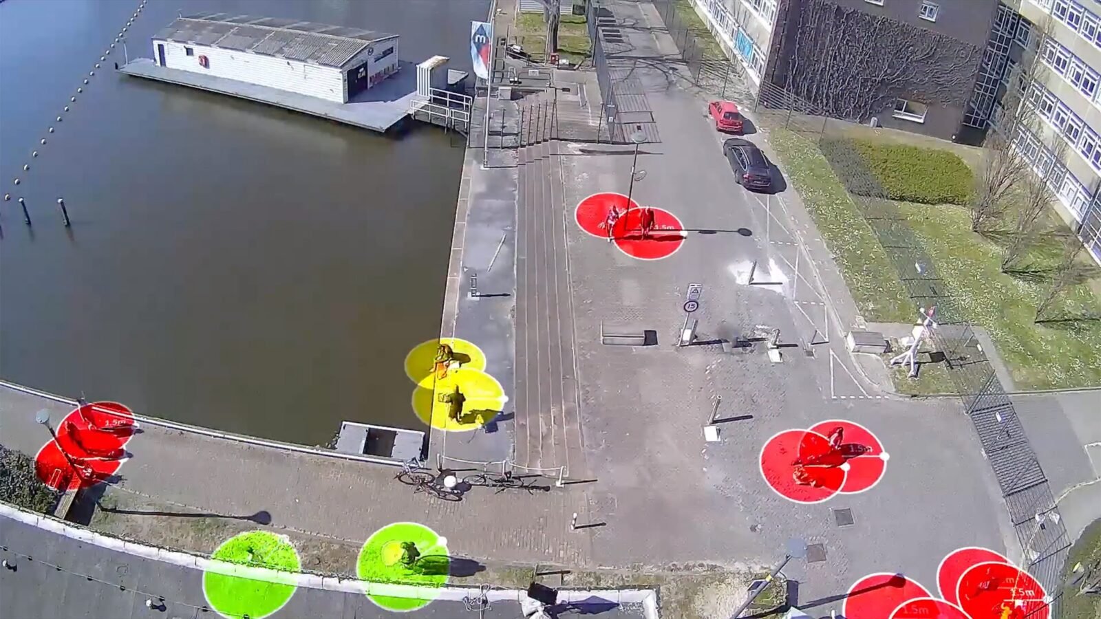
Another example is Social Distance Thing by The Incredible Machine, a design agency in Rotterdam. The Social Distance Thing casts a laser onto the ground showing a perimeter of your social distancing “personal bubble”. The space required, usually between 1-2m, can be adjusted as necessary to show the boundary of distance between you and the next person needed. While it might not always be practical to walk around in public with a laser boundary around you, this project highlights not only the newness and unfamiliarity of having to stay distanced from others, but that we often find ourselves in places where keeping this distance is difficult and hard to measure or gauge for yourself.

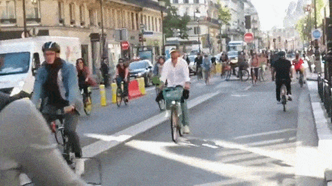
Tom at Tapp.nl used the instructions to make the Social Distance Thing available open-source on Instructables to create NORM, a map of Amsterdam based on the ability to be socially distant. This follows other mapping and traffic restriction initiatives globally that reframe how much space we truly have in public spaces especially when you take motor, bike and pedestrian traffic to share that space with.
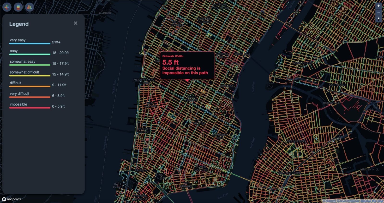
One mapping initiative is Sidewalk Widths NYC which maps, categorises and colour codes New York City walking pavements based on the space available to maintain social distance. While this can be helpful in planning outings or walks where there is more room, it is concerning that there are whole neighbourhoods lined with orange (difficult to maintain social distance) and red (impossible to maintain social distance) streets on Sidewalk Widths NYC. Mapping the inaccessibility of sidewalks and city centres in New York City and beyond is important work to push for new public policies, such as traffic calming and extending pedestrian spaces in the city.
While narrow and inaccessible streets are clearly a long-standing issue for wheelchair users, parents with prams and anyone needing more than a couple of feet of space, the new pace of life and restricted travel and movement in cities during the pandemic offers the perfect opportunity to rethink our streets to provide better public spaces for all its citizens in the long term. In general, we have come to value and prefer spaces that are open and where you can be sure to keep your distance. It is clear that people are thinking about the city in a different way and planning their use of the city in new ways using the solutions these mapping and social distance tools offer.